The United States redrawn by driving time
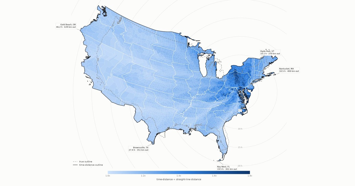
Every county keeps its true bearing from the U.S. Capitol in Washington D.C., but its distance is replaced by driving hours at 1 hour = 100 km. The rings are hours; the dashed grey line is where the country really is.
sf_weighted_map
PythonJavaScriptOSM
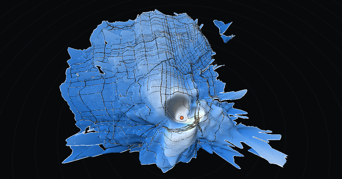
San Francisco redrawn so distance from any point is travel time: on foot, by bike, by car at any hour of the week, or by helicopter. The whole street graph ships to the page and routes in the browser.